
Wrangell-St. Elias National Park: an Introductory Guide

The year is 1912--the same year the Titanic sank; 7 years before women gained the right to vote. 40-year old Dora Keen shows up in a small mining town in Alaska and assembles a team of prospectors--not mountaineers--to assist her in an ascent of Mount Blackburn. After a failed attempt in 1911, Keen is back for a second try at this unsummited mountain, the tallest in the Wrangell Mountain Range. This time she is successful, climbing over 16,000 feet with archaic tools compared to today and WEARING A SKIRT. A true badass in a time when female mountaineers were virtually nonexistent, it’s stories like Keen’s that I think of when I think of Wrangell-St. Elias National Park.
While, yes--this is the largest park in the U.S. by more than 1 million acres, and yes, it’s the only park that holds four different mountain ranges, and 35% of the park is covered in glaciers--it’s hard to comprehend the vastness of it all while you are standing in it. My visit to this park was instead filled with anecdotes about people like Dora Keen, whose connection to this wilderness was found in intimate knowledge of a little, rather than the grandeur of superlative.
Getting There
I visited Wrangell-St. Elias for a few days in August of 2018 as part of a larger trip to the Anchorage area. I originally started looking into it because it’s one of three national parks in Alaska that you can drive into...which is funny, because I ended up flying in on a bush plane.
There are two roads that lead into the park. On the northern side lies Nabesna Road, but the more famous McCarthy Road enters the park from the west. In comparison to the gargantuan size of the park, both roads are relatively short, and neither cross through the park from one end to the other. This is not your typical “drive through and stop at the overlooks” type of park.
Upon further investigation into McCarthy Road, I found multiple recommendations to travel with a full-size spare and be comfortable changing tires in the wilderness if taking this route. McCarthy Road was once a rail line leading to the small mining town of Kennicott (and nearby McCarthy) and apparently much of the railway was left behind, including spikes that will pop your tires. Sounds fun, right?!
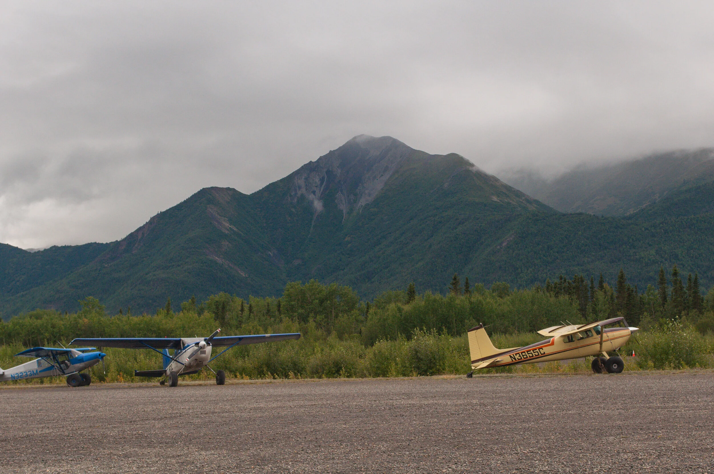
Since this was a solo visit in a rental Camry, McCarthy Road was a hard pass. Instead, I drove to the nearby town of Chitina, where McCarthy Road begins, and hopped on a short bush plane flight with Wrangell Mountain Air.
The Flight
There are a few different options for flights into McCarthy. I was coming from Anchorage and narrowed down the choices to either flying straight from Anchorage or driving five hours to Chitina and flying from there. The price difference made this a very easy choice.It also gave me the opportunity to stop in the visitor center in Copper Center and chat with park rangers on my way in.
The bush flight itself was a short 20 minute commute from one gravel strip to another, crossing above miles of untouched wilderness. The flight was incredibly smooth, boasting incredible views of glaciers!

Where to Stay
Figuring out where to camp before I arrived was probably the most confusing and anxiety-inducing part of this whole trip. From what I could find, it looked like there were a few developed campgrounds along McCarthy Road, but only dispersed backcountry camping within the rest of the park.
As someone who had never dispersed-camped or backcountry camped prior to this trip, this was not my jam. Also as a solo traveler who likes to let people know in advance where I’ll be, this was not my jam.This was the first time ever that I was heading toward a park without any idea where I’d be sleeping that night.

Lucky for me, the park rangers in Copper Center were very helpful in answering questions. They told me of Root Glacier Basecamp, which is essentially a large parking lot at the end of McCarthy Road, just across the footbridge from town. When I arrived, the campground owner charged me $10/night and pointed me toward a path parallel to the river for walk-in camping.
This was the right decision for my level of experience at the time. If I were to repeat this same trip, I would almost definitely choose to backcountry camp outside of Kennicott. Staying at the campground kept me anchored to town instead of experiencing the wilderness more, which is what I was hoping for.

How to Get Around
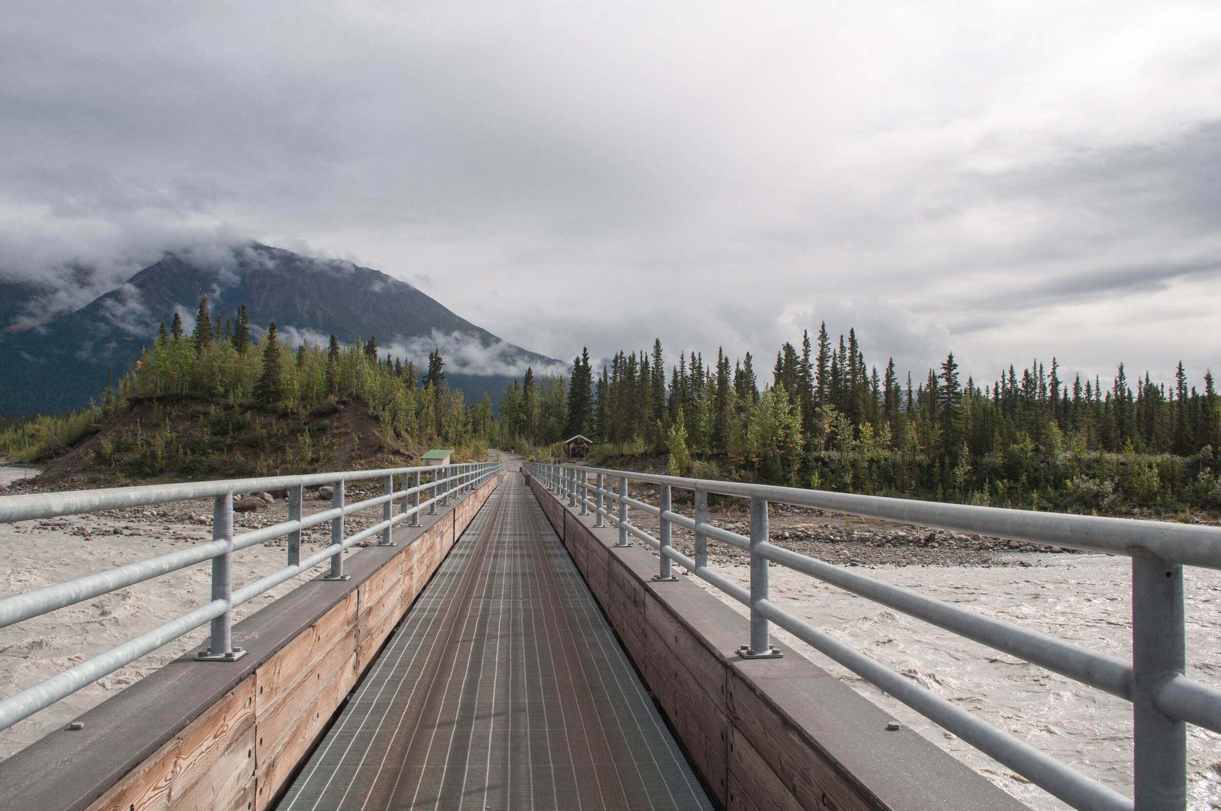
McCarthy Road ends at a campground/parking lot. From there, a footbridge crosses over the Chitina River leading into the small town of McCarthy. From McCarthy it's another five miles to Kennicott up the road. You can walk there if you want, but there’s also a shuttle service that runs around both towns for $5 cash.
I had no problems walking tohe short, maybe half mile from the footbridge into McCarthy (even with the road washed out in a few places) and took the shuttle into Kennicott. The day of my guided hike, the tour company picked me up at the footbridge.
McCarthy
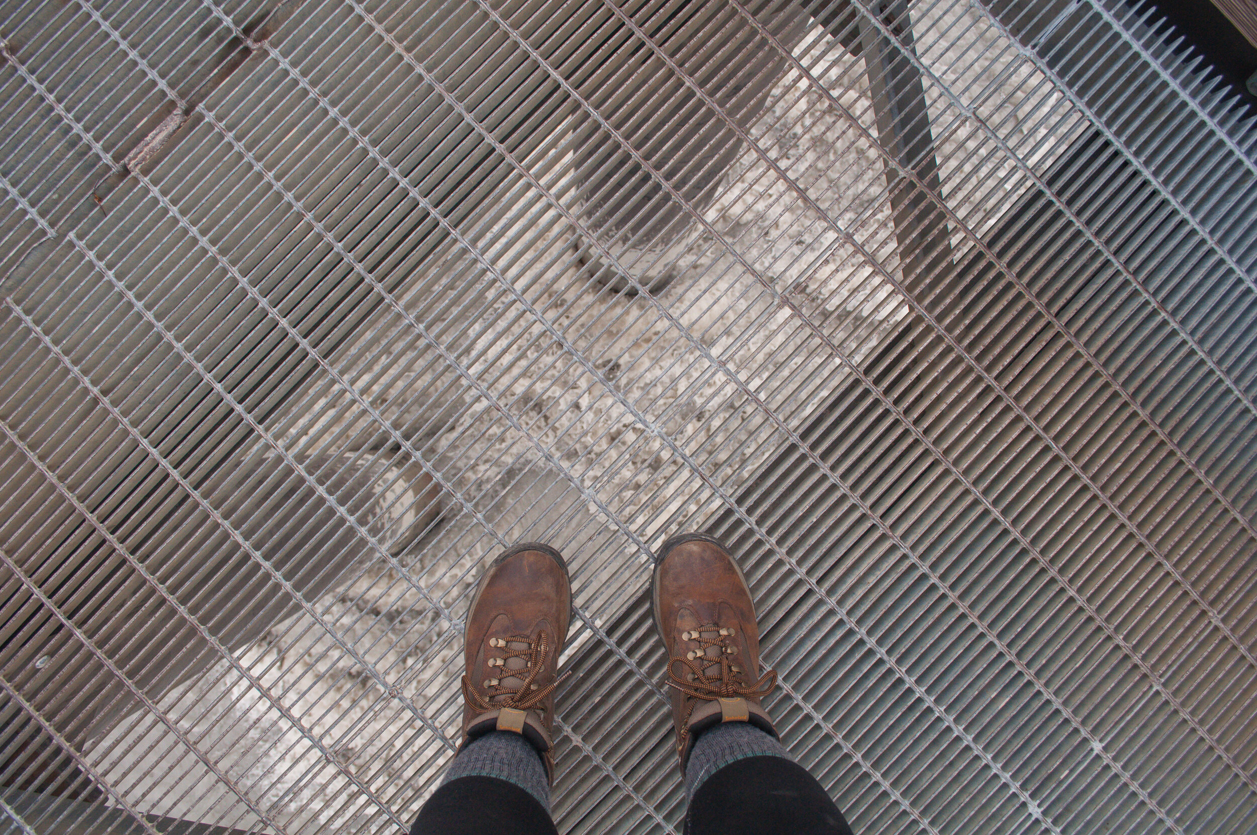
After arriving in the area and setting up camp, I made my way across the footbridge to check out McCarthy. First of all, though, the footbridge itself was probably my favorite thing about this area. The whole bridge is grated metal so you can see the power of the river beneath you. I had briefly considered a rafting trip as part of my visit to Wrangell but opted to kayak in Kenai Fjords National Park instead. Next time I’m in Alaska, though, I’m making a point to get out on a river. I spent a lot of time hanging out by the water over the next few days.
McCarthy itself sprung up in the early 1900’s in response to the needs of the miners in Kennicott--and when I say “needs,” I mean booze and women. *insert eyeroll emoji here* It’s a town that was built to supply all the things that weren’t allowed in Kennicott. To this day it continues to hold onto a shadow of it’s old reputation as Kennicott’s looser (and maybe more fun) younger brother. Among the establishments in town today you’ll find a museum of town history, a restaurant, and a bar.
The museum had closed for the day by the time I made it into town, but I popped into the general store for some ice cream and learned some local folklore from the store manager.
Root Glacier Hike
I was up at 7:30 the next morning in order to be at the footbridge for pickup by 8:30. There were 10 of us gathered at the bus stop awaiting the arrival of our ride to adventure. Just glancing around at what everyone was wearing made me feel less and less prepared for the day ahead of me. Almost everyone had on some kind of actual, waterproof-looking hiking pants (I was in leggings), with lots of layers and much bigger packs than my own.

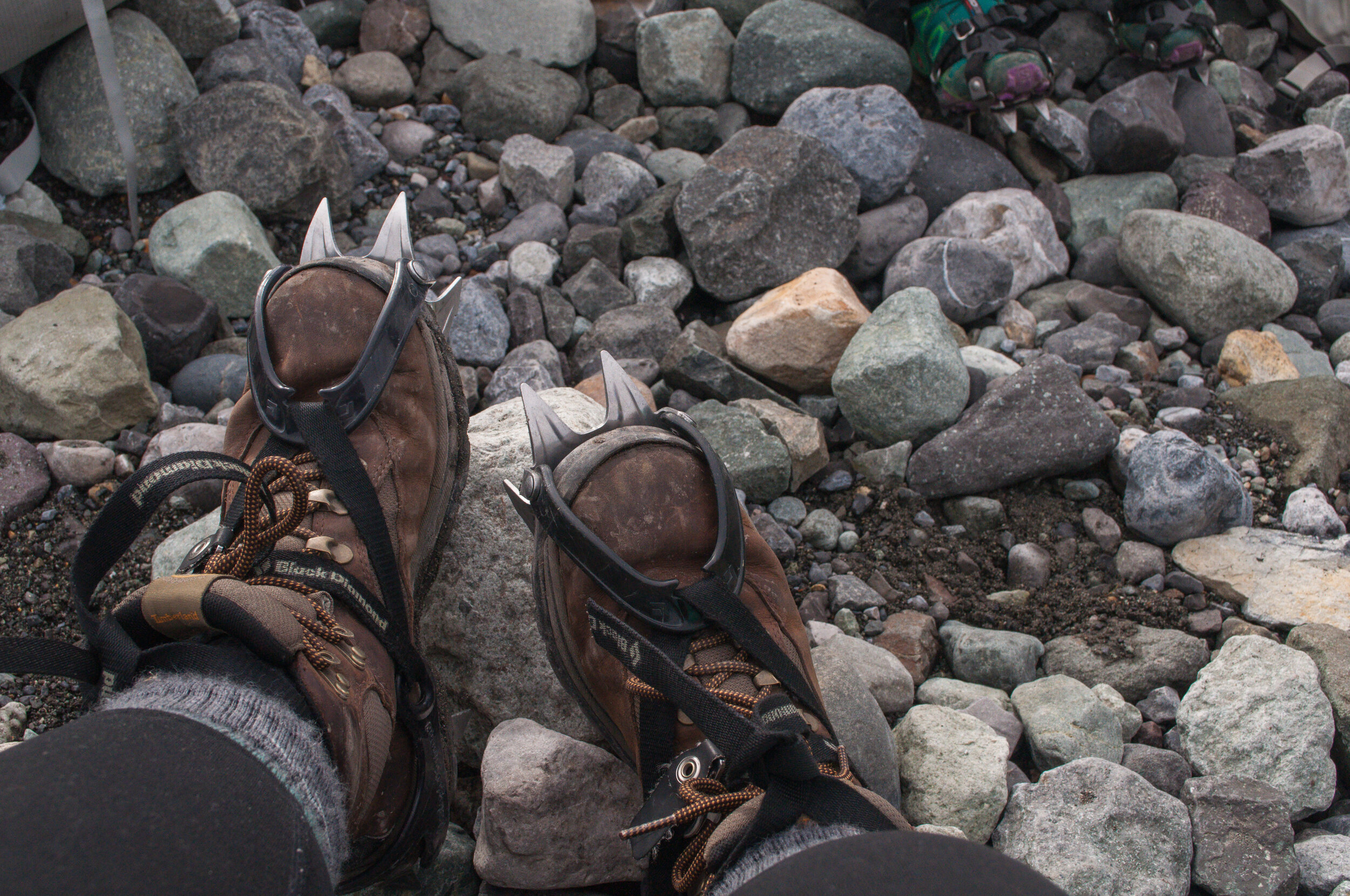
We were dropped off at the St. elias Alpine Guides office in Kennicott and I continued to feel like I had gotten myself in over my head as my guide fitted me for crampons. The office was crowded, but there were a lot of different groups leaving on separate outings. My group ended up being just myself, a couple, and out guide.
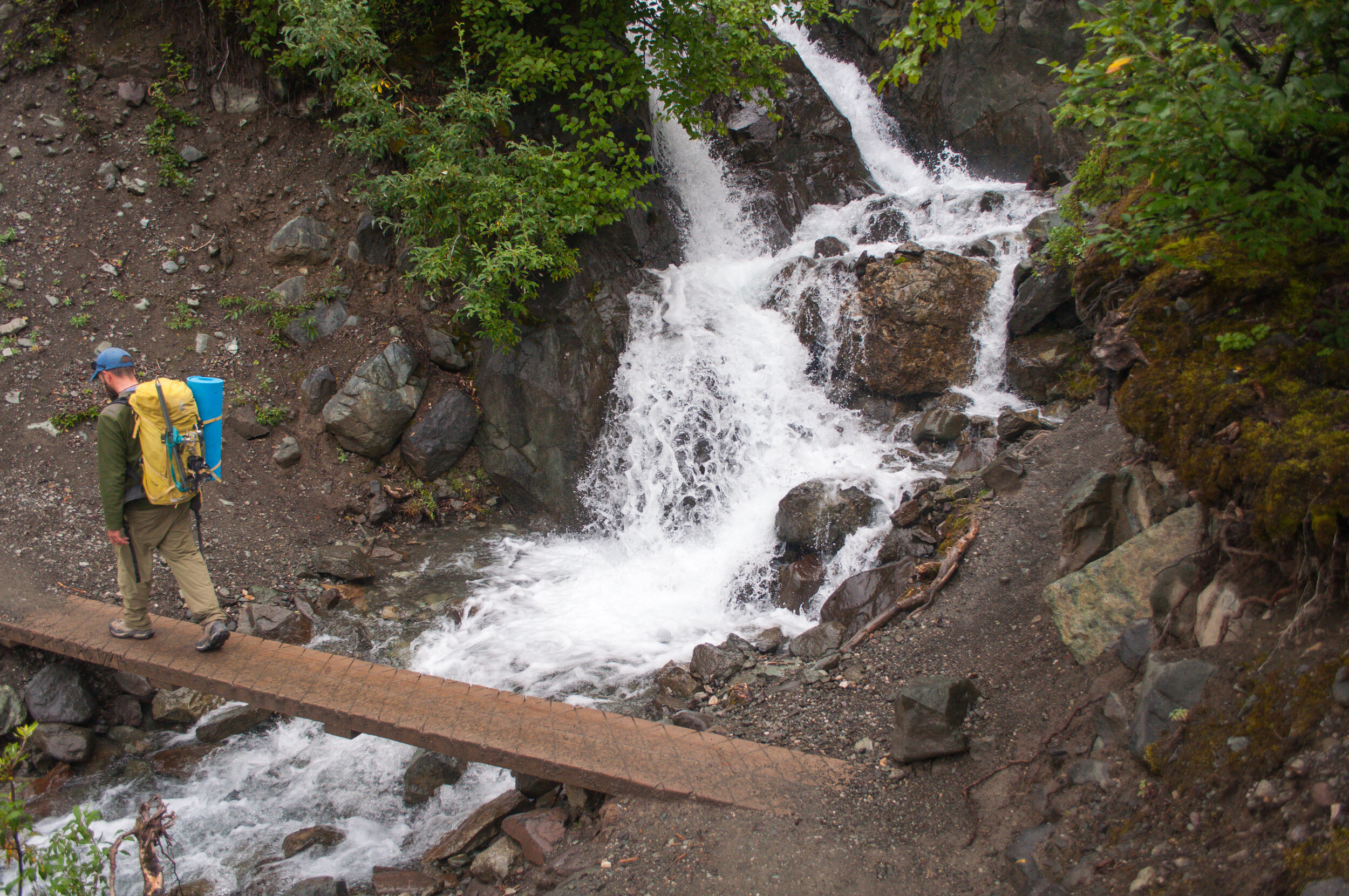
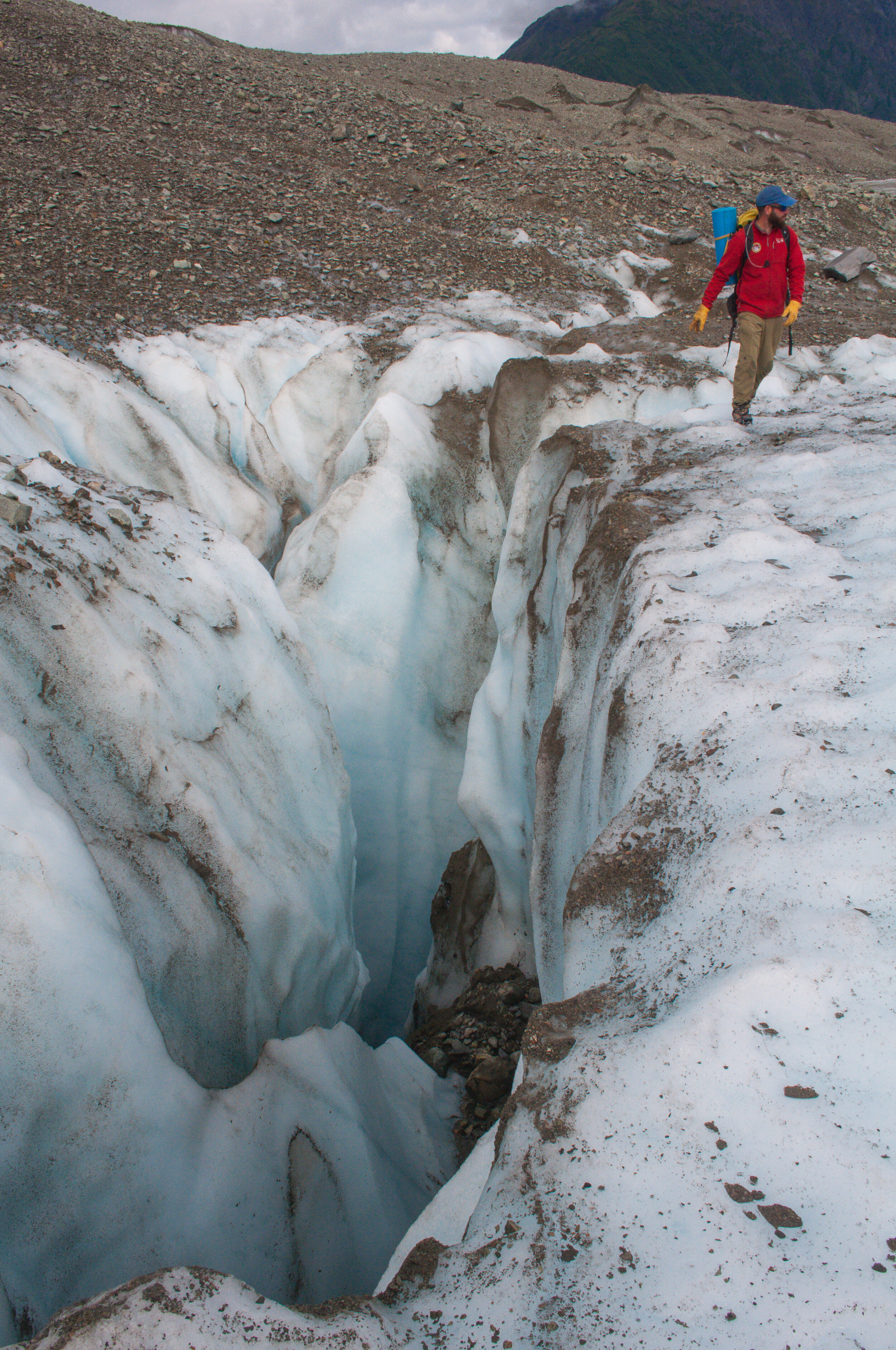
The two mile hike to get to Root Glacier is pretty easy, with just a few steep sections. This trail is pretty by itself, and would be an easy way to get up close to a glacier even if you weren’t planning to go out on the ice.

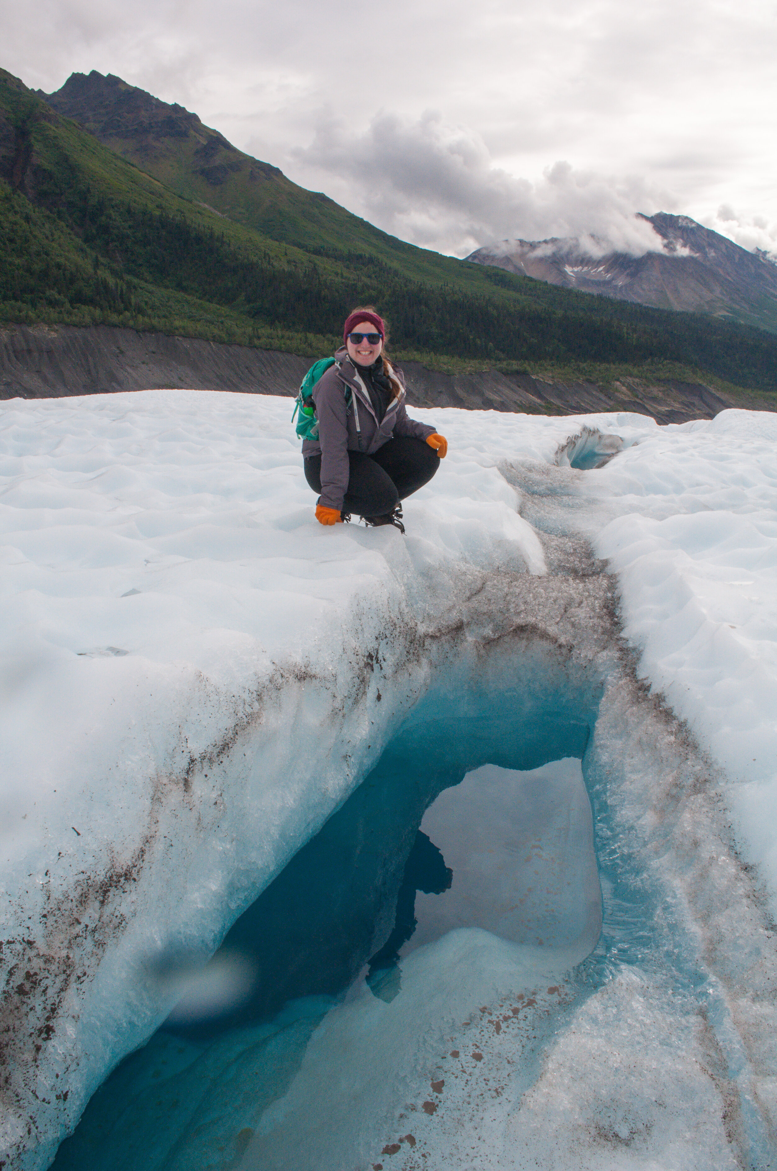
We sat at the base of the glacier and the guide showed me how to put on my crampons. He then adjusted them for me, like a parent making sure their toddler’s feet were securely in their shoes. He gave a quick demonstration on how to walk on the ice with crampons strapped to our feet, and then we were off! I was extremely surprised at how stable I felt on the ice. Stomping around more than normal initially had me concerned that I would tire much faster, but the whole hike turned out to be a lot of fun; as the day went on, my fears wore away.

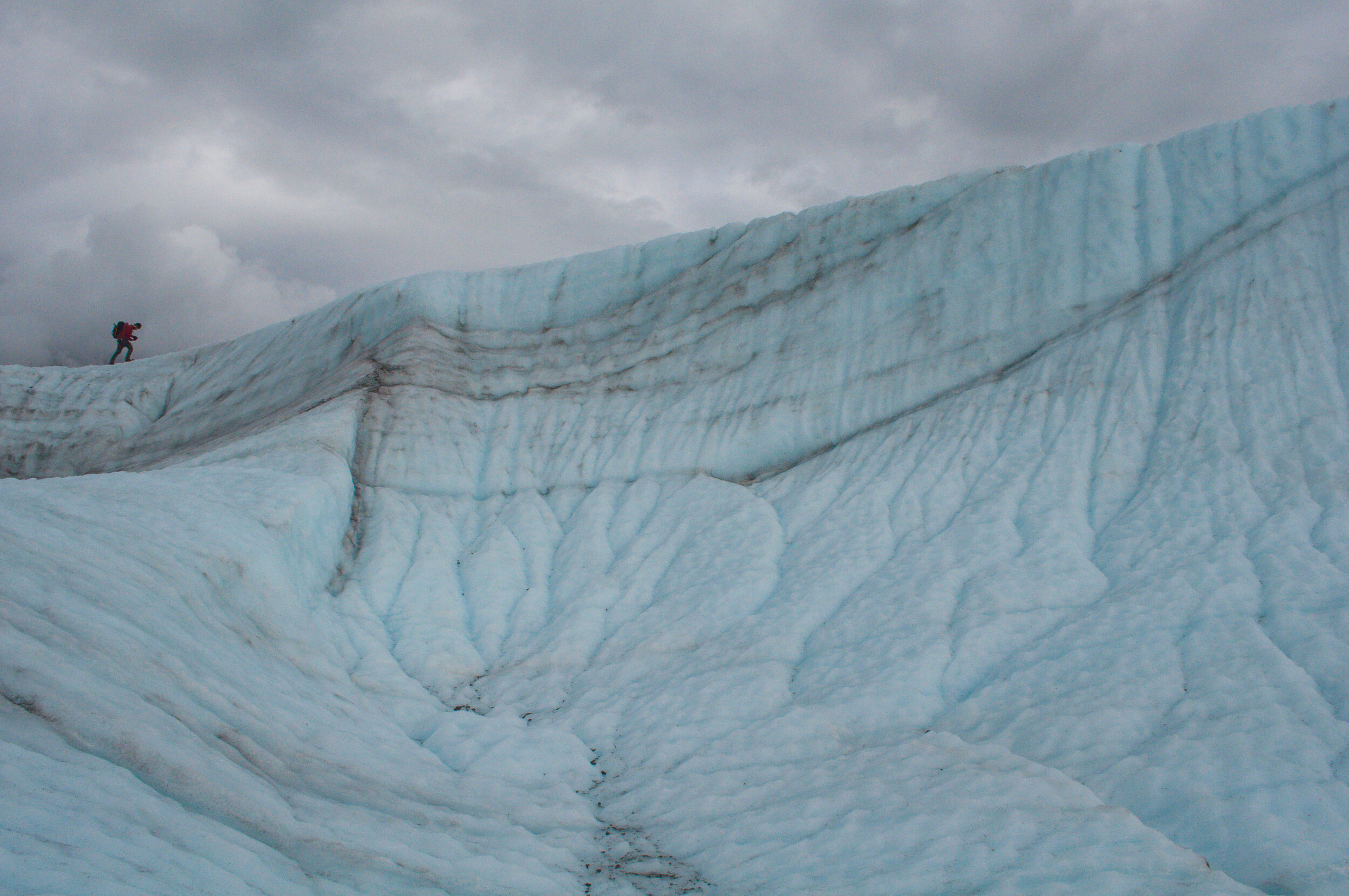
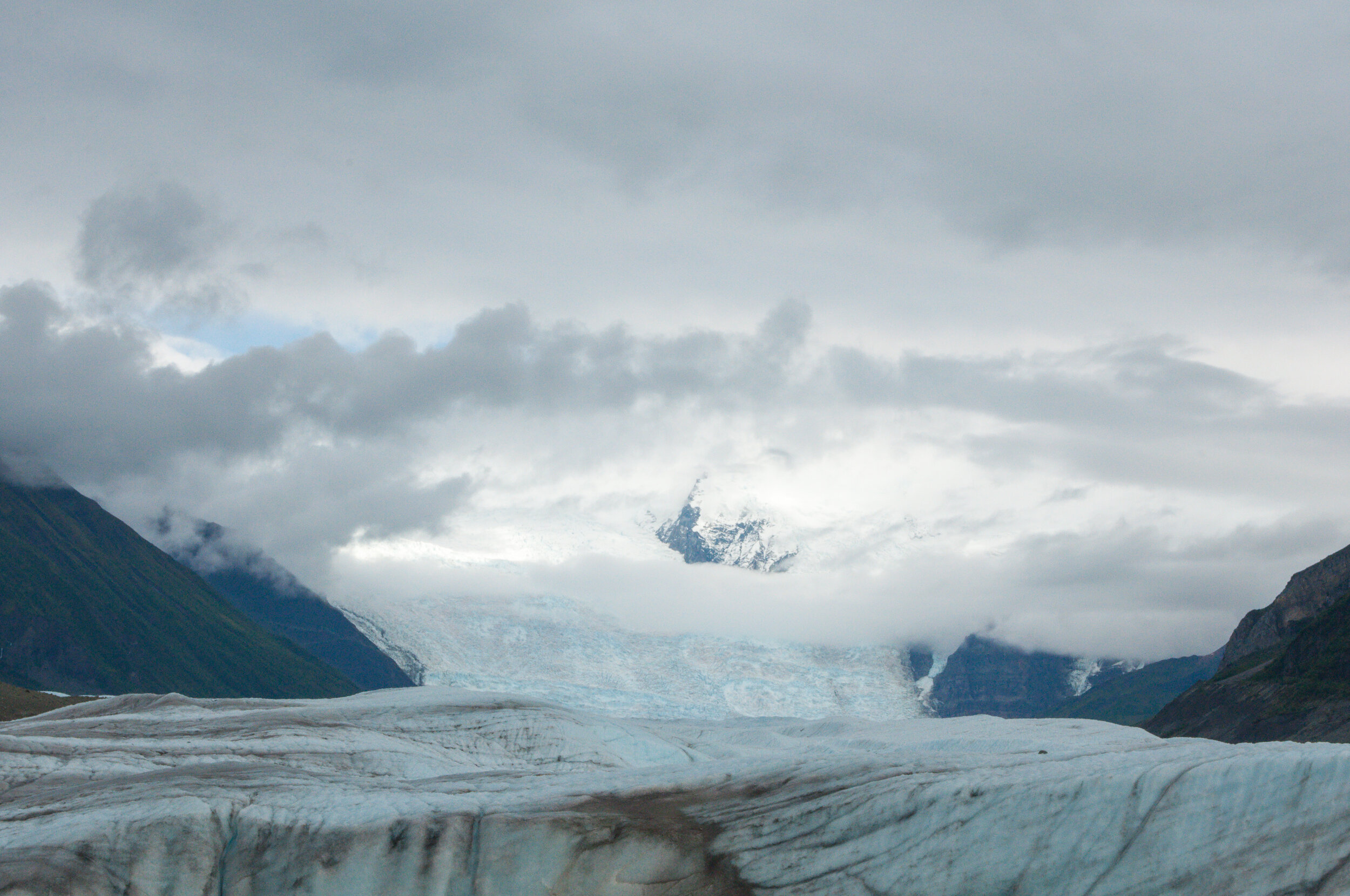
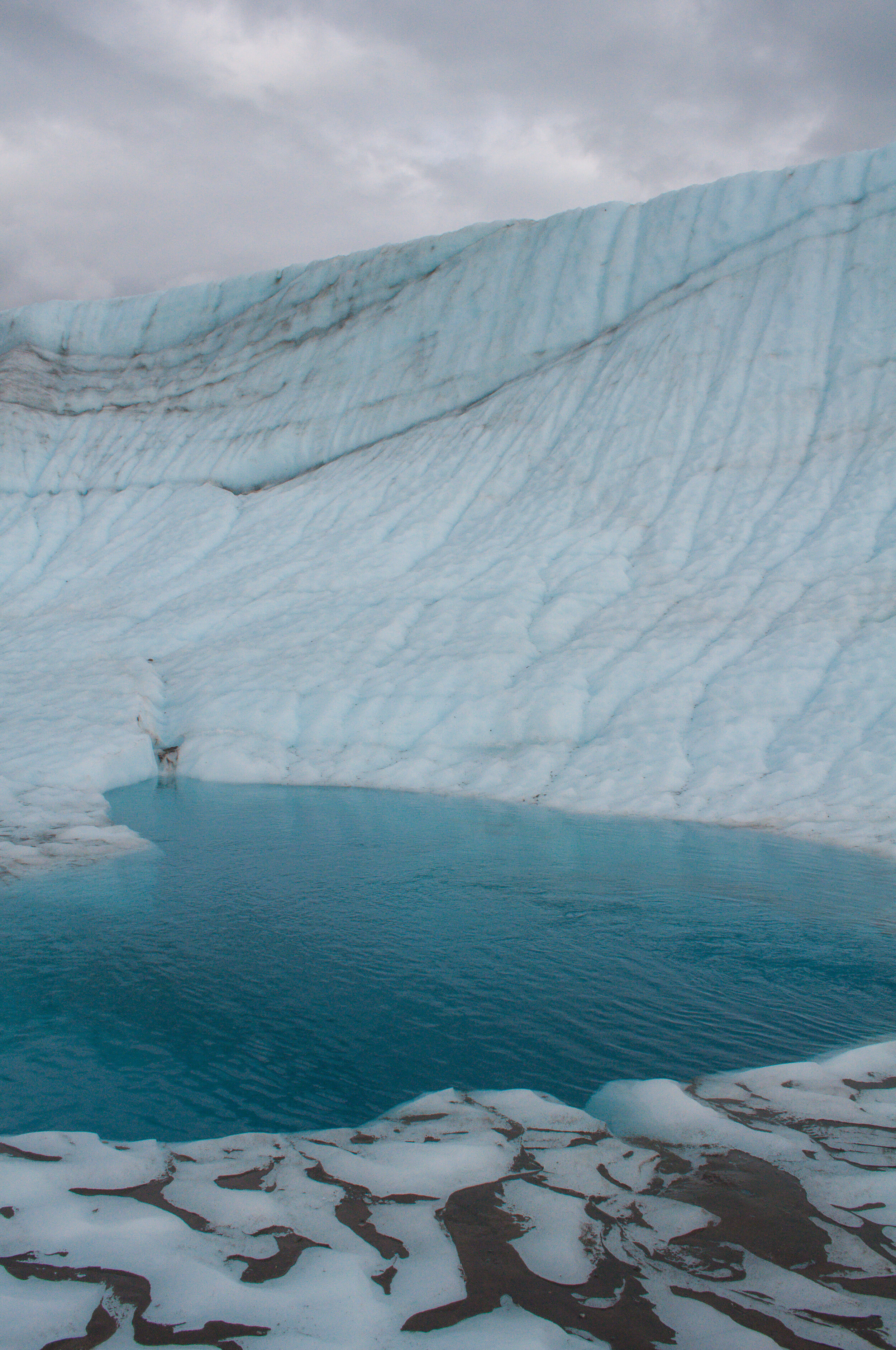
Walking on a glacier is similar to being on the ocean in that I had absolutely no sense of scale. Glaciers constantly change, so there was no specific route to walk. Our guide pointed out geological features like lateral and medial moraines, kryokinate, moulins (a.k.a. The water slide of death), etc., and filled us in on some of the history of the area. We headed toward Stairway Icefall, which is the tallest icefall outside of the Himalayas, about 6 miles in the distance. The ice began to be less covered in dirt and more white, so I had a really hard time seeing where I was putting my feet. We crossed over the medial moraine and stopped in a little valley for lunch.
Besides an introductory ice climbing class, we were the only people out on Root Glacier that day. For one of the most popular spots in the park (if not the most popular spot in the park), we were very lucky to have it all to ourselves--one of the perks of being there very late in the season.
SEAG dropped us back in McCarthy around 5:30pm, where I had dinner with new friends at the Potato.
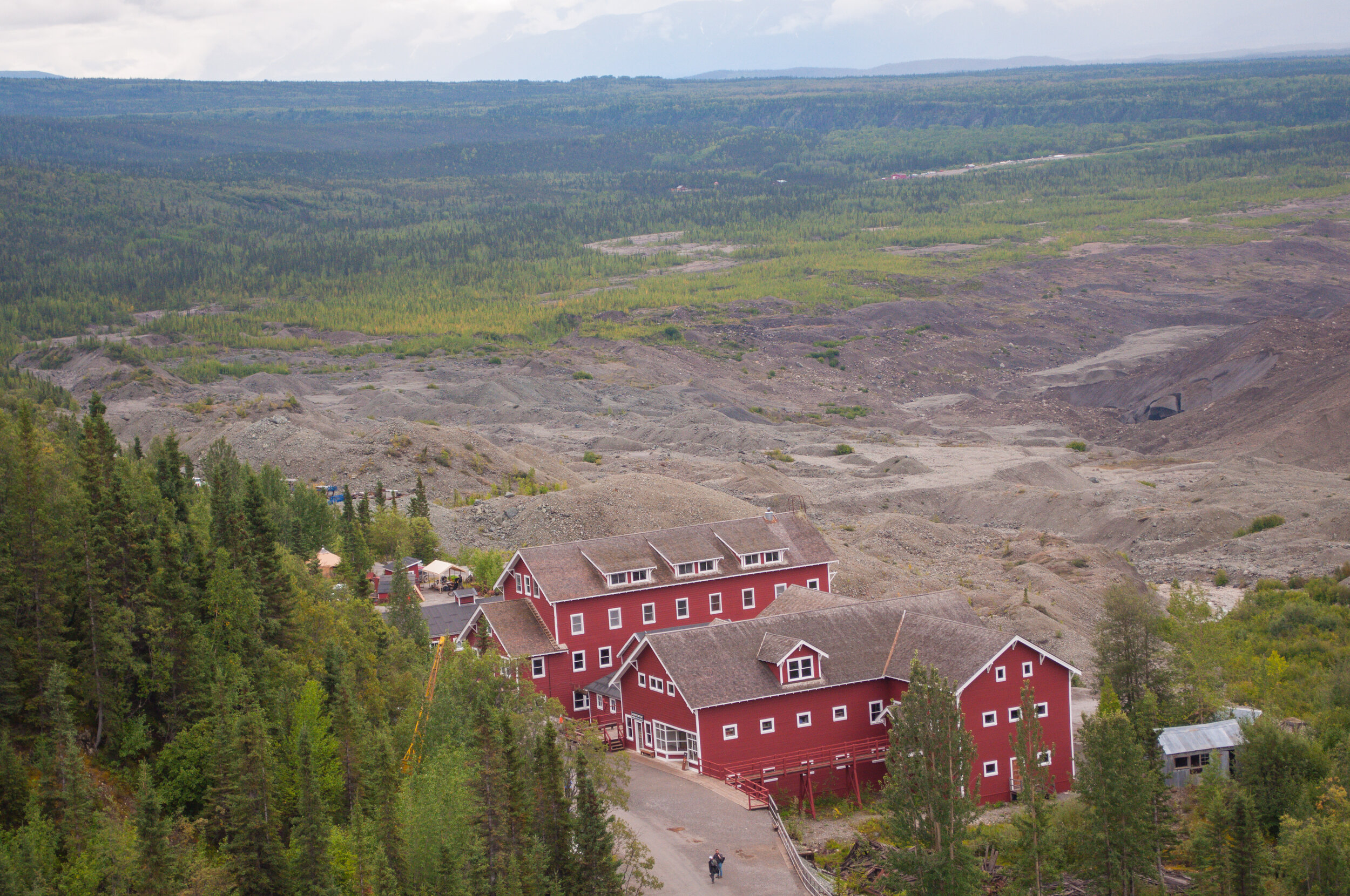
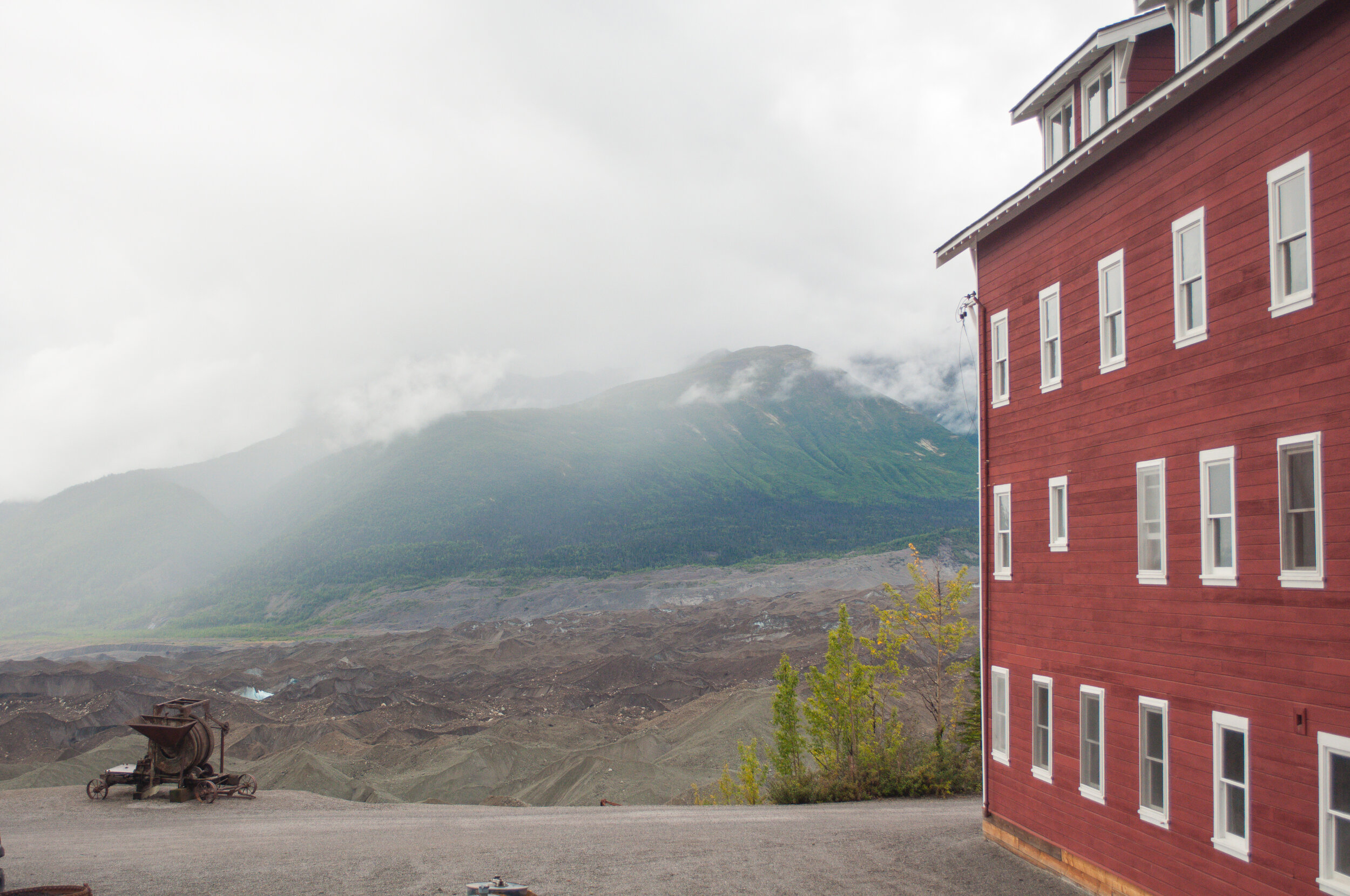
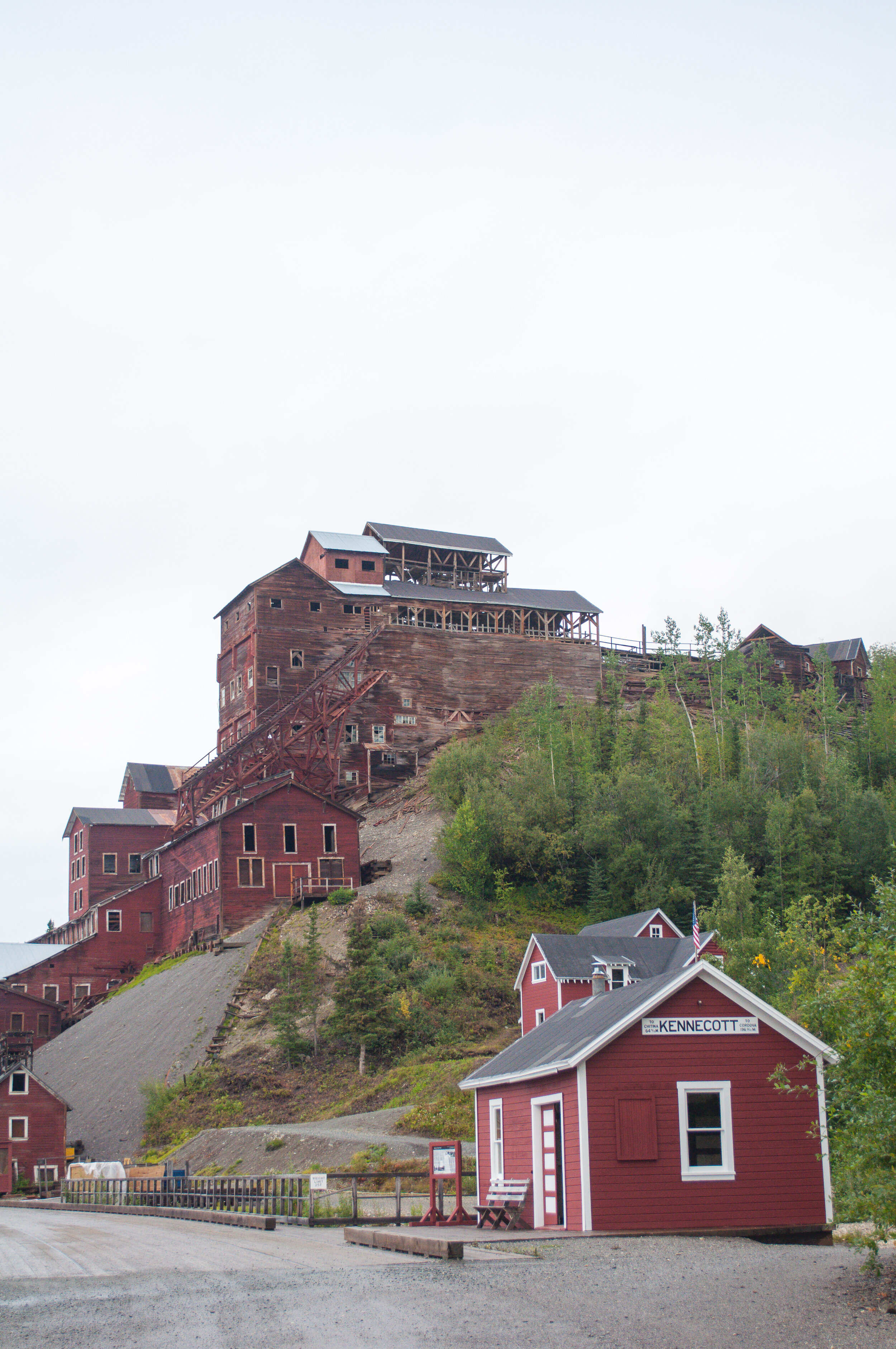
Kennicott
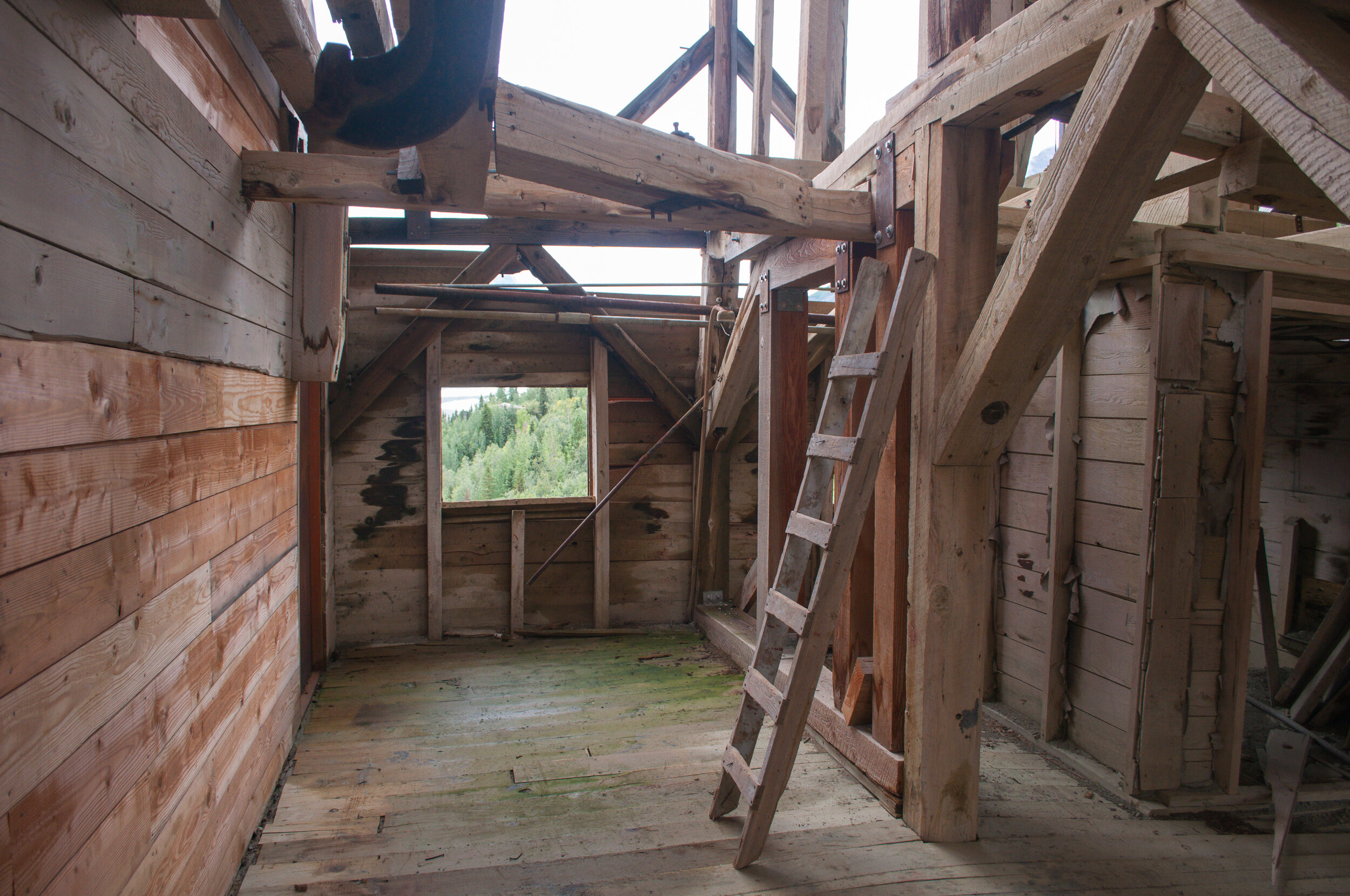
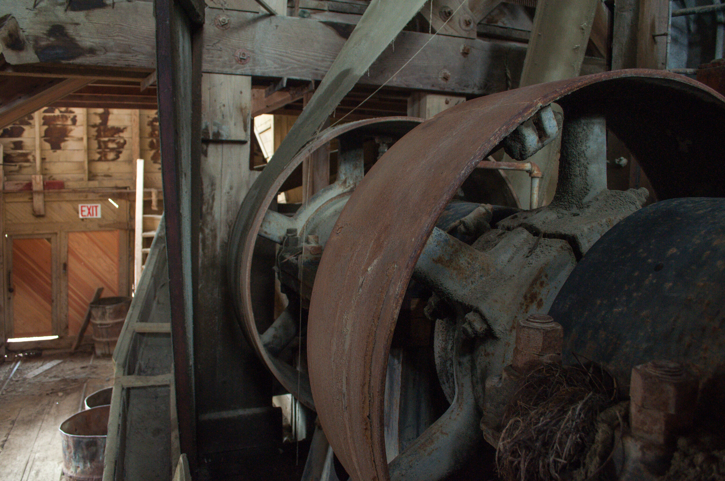
While McCarthy is not technically part of the national park, Kennicott is. The old mining town has been preserved as a historical landmark, and the brick red buildings are striking against the green and gray mountains behind them. The day after my glacier hike, I decided to take it easy and hang out around Kennicott. St. Elias Alpine Guides hosts a guided tour for $28. This seems kinda on the pricey side for a tour, but it lasts two hours and is the only opportunity to go inside the 14-story mine building.
There were about 10 people on my afternoon tour, and I was by far the youngest. The tour walks through the buildings in town and provides more interpretation than the waysides, and then up a hill to the top of the wooden mine building, where you then don a hardhat for your expedition. This tour is for history lovers, and is a great way to gain more understanding of the town of Kennicott.


For Next Time
I spent too much time in town on my visit to Wrangell-St. Elias. This might be how some people prefer to visit this park, but not me. For a park known for large, vast wilderness, I was intimidated by the trails (or lack of trails) and it kept me from venturing away from McCarthy and Kennicott. The glacier hike was incredible, and my next visit to this park will consist of even more breaking out of my comfort zone!
If I do go back to Kennicott, though, I’d like to hike up to Bonanza Mine, past Root Glacier. It’s a steep 9-mile round trip hike, which I didn’t make time for on my visit. I’d also be interested in spending some time out on the rivers, or more time on ice! With such a large amount of ice in the park, seeing and/or standing on glaciers is an absolute must for a Wrangell visit.
The park is also accessible from the north along Nabesna Road, or by boat along the Hubbard Glacier area. However you choose to visit, there’s really no way to “see it all.” I guess that just means I’ll have to go back!


